Explore
Map of Clare
Original print of map of Clare drawn and engraved for Lewis' Topographical Dictionary, 1830s.
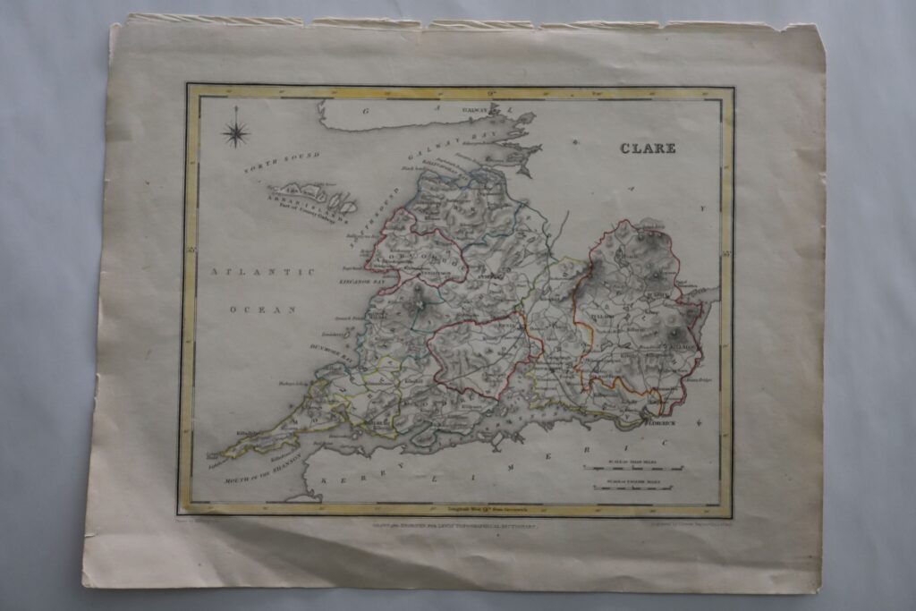
Original print of map of Clare drawn and engraved for Lewis’ Topographical Dictionary; colored yellow around the edge of the map, barony borders are outlined in different colours, otherwise black and white.
Purchased by Dr Alicia St Ledger, researcher for the design company that was contracted to set up the long-term Riches of Clare exhibition at the museum, but was never used and was added to the collection.
Category: Communication Equipment